How to Plan a Mt. Everest Trip?
In general, a regular Everest tour refers to a visit to Everest Base Camp. There is no problem for foreign tourists (including overseas Chinese) to visit Everest Base Camp. However, if it is to go to the depth tour of Mt. Everest climbing, whether the process, preparation work, the difficulty will be more complex. This article is aimed to bring you a brief introduction regarding various types of Everest tour for the overseas Chinese, and foreign tourists.
Introduction of Mt. Everest:
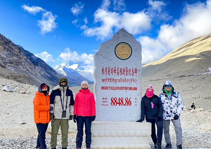
Mt. Everest must be familiar to people all over the world. As the highest peak in the world, it has been attracting the attention of numerous domestic and international tourists. The Northern part of Mt. Everest is located in China border, belonging to Tingri County, within total of 6 camps. They are: the north slope base camp is 5200 meters above sea level, the transition camp is 5,800 meters above sea level, the forward camp (ABC) is 6,500 meters above sea level, C1 is 7,028 meters above sea level, C2 is 7,790 meters above sea level, and C3 is 8,300 meters above sea level. South of Mt. Everest is located in the Khumbu region of Nepal, with a total of 5 camps, respectively: base camp on the south slope is 5,364 meters above sea level, C1 is 5,980 meters above sea level, C2 is 6,400 meters above sea level, C3 is 7,300 meters above sea level, C4 is 8,000 meters above sea level. The East slope belongs to Qudang township, Tingri County, the east slope base camp is at altitude of 5,313 meters, can only be reached by foot, vehicles cannot arrive. West slope in Zhaxizong Township, Tingri County.
Regular sightseeing tour of Everest Base Camp for Foreign tourists
Ticket: RMB 180.00 (even the tour guide has to pay for the ticket)
Vehicle entering fee: each wheel charges RMB 100.00, the driver does not need to pay for the ticket.
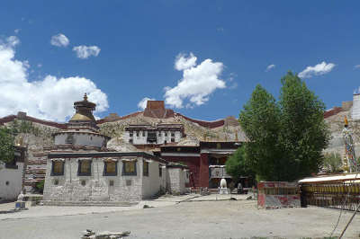
The common sightseeing base is located at 8km south of Rongphu Monastery, Tingri County. From the entrance of Mt. Everest National Geopark to the Base Camp of Mt. Everest, there are 102 kilometers of winding mountain road, along the way is meandering, ravines and gullies are criss-cross, and the climate change is unpredictable. Nevertheless, the road conditions are good. The camp is open in a tent area, with a tent post office. Except for two public toilets representing modern civilization, the base camp has no permanent buildings. From mid-to-late April to mid-to-late October, tents is setup here to receive tourists from all over the world. From late November to early April, due to the weather, the tents were evacuated. If tourists want to visit the base camp of Mt. Everest, they can only stay in the guesthouse of Rongphu Monastery or return to the hotel in Tingri.
For the details, please refer to the route of “8 Days Classic Tour of Mt. Everest”.
Everest climbs routes introduction for Foreign tourists
There are as many as 19 climbing routes to Everest. There are two major climbing routes. One is from the south slope of Nepal, and it was first climbed by Edmund Hillary and Sherpa Tenzing Norgay in 1953. The other is from the north slope of China's Tibet region climbing, by the Chinese mountaineering team of three people (Wang Fuzhou, Gongbu and Qu Yinhua) completed the first climb in 1960. Climbing the mountain from the Nepalese side (also known as the south slope) is relatively easy and cheap, with the highest number of climbers reaching the summit.
South slope of Mt. Everest
To reach the summit of Mt. Everest from the south slope, you need to take a helicopter from Kathmandu to Lukla at an altitude of about 2,800 meters. Besides taking a helicopter, you can also take the land route by vehicles, however, it is very troublesome, besides bus and vehicles, you have to track for 4 – 5 days to reach Lukla. Starting from Lukla of south slope, you firstly have to hike 6 – 7 days to arrive the Camp in south slope. (Can also take the helicopter from Lukla to the south slop Camp), the climber process from the south slop camp to the Everest Peak, takes about 35 days, including various adaptive training.
North slope of Mt. Everest
Climbing from the north slope of the mountain, you can directly ride the vehicle from Lhasa to EBC. At present, the road from Lhasa to EBC is in good condition, about 700KM one way, and it will take two days. After being adjusted from the EBC of the north slope, you have to stay in a transit camp, advance camp, C1, C2, and C3, eventually climb to the summit of the Mt. Everest, and the total time were within the 1-2 month.
In general, the south slope of Everest is under Nepal jurisdiction, due to a variety of commercial climbing companies, the competition is large, the price is relatively cheap, the requirements of the body is not so strict, and the north slope of Everest is only in charge of the Tibet Holy Land Company responsible for the arrangement of Everest climbing matters. Whether south slope or north slope, with the rise of the commercial Mt. Everest, the number of people who climb mount Everest is increasing, and the price is becoming more and more expensive, ranging from RMB 300,000.00 – 500,000.00/person.
Recommended hiking routes for foreign tourists:
1. Sagarmatha, Nepal – EBC (15 – 18 days)
On the southern slope of Mt. Everest in Nepal, there is a national park called Sagarmatha, which is located in the solokhumbu area of Kathmandu. In the park, there is a famous Nepalese EBC hiking route, a 150KM round trip hiking route, starting from Lukala (at an altitude of 3,000 meters) and ending at EBC south slope (at an altitude of 5,360 meters). The line is very beautiful, with Snow Mountain, forest, and lake... The total hike route takes about 10-14 days. If you are a hiker with more energy, can consider hiking around the EBC loop. The return journey will take about 15-18 days to cross the Gacuola pass at an altitude of 5,420 and enter the Gokyo RI trail.
2. Old Tingri, Tibet Region – EBC (about 4 days)
At present, this route has not many climbers, the whole journey is about 70 kilometers, takes about 3-4 days. Along the way there are small village accommodation, but be sure to bring tents and stoves, just in case, cold clothing also have to bring. Stating from old Tingri (Gangga), you may spend 4 days of trekking to reach to the EBC. You can rent a horse or yak in Old Tingri, basically the cost of carriage of the whole journey will cost RMB 3,000.00. The difficulty of this line is relatively low, and many small local villages are scattered along the route, where you can experience the life of local Tibetans.
3. One of the classic trekking routes – East of Mt. Everest - Gama Valley (7 – 10 days)
Gama Valley is known as the most beautiful valley in the world. The valley, which starts from Chentang in the east to the Dongpo of Mt. Everest in the west, is a valley from more than 2,000 meters to 5,000 meters above sea level. The entire valley is inaccessible and contains the largest and most intact pristine forest in the Everest region. Karma Tsangpo joins the Bum Chu Riber at Zhentang Town, with only 2,100 meters above sea level. The entire hike will take about 7 to 10 days, running through primeval forests that cover almost all seasons and the difficulty coefficient is above medium. The climate here is changeable, the vegetation is dense, the altitude is high, and the human existing is rare. If you are not the professional hiker or the very experienced outdoor tourist, do not recommend this hiking route.
4. North slope of EBC – 5,200M – Advanced Camp – 6,500M (about 5 days)
The ABC advance camp on the north slope of Mt. Everest is the highest hiking site in the world. The starting point and the lowest altitude of the hiking are up to 5,200 meters above sea level. However, 6,000meters is considered as a restricted zone, which only very few people can reach. The ABC is 6,500meters, is a narrow valley of 1KM under the ice wall of the north slope of Mt. Everest, the air is very scarce, in general, whether can hold on for a week in the camp, is also an important test to climb Mt. Everest. The whole hike took about five days. On the way, you will visit an ice lake, ice towers and glacier. Compared with ordinary hiking routes, ABC hiking requires higher physical quality, and the scenery is no longer primeval forests, lakes and animal vegetation.
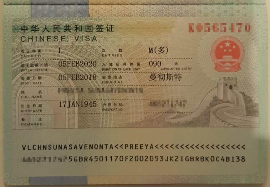
The above mentioned routes, are all open towards foreign tourists, the only difference is: different route requests different certificate, with different application process. For the details please refer to: What kind of certificate is requested while taking the tour to EBC?




 Data in submission...